Файл:Old map 1807 plan.jpg
Розмір при попередньому перегляді: 505 × 600 пікселів. Інші роздільності: 202 × 240 пікселів | 404 × 480 пікселів | 1004 × 1192 пікселів.
Повна роздільність (1004 × 1192 пікселів, розмір файлу: 519 КБ, MIME-тип: image/jpeg)
| Відомості про цей файл містяться на Вікісховищі — централізованому сховищі вільних файлів мультимедіа для використання у проектах Фонду Вікімедіа. |
Опис файлу
| Опис |
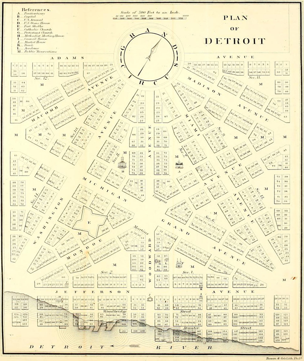
English: Detroit city layout plan circa 1807—following the 1805 fire that destroyed most of the city. The map shows Grand Circus Park (top), and some of the present-day Grand Circus Park Historic District. |
| Час створення | близько 1807 |
| Джерело | Dickens, Asbury & Forney, John W., eds. (1832) "Plan of Detroit" (Map). American State Papers. Vol. 6: Public Lands. 1:6,000. Washington, DC: Gales & Seaton. p. 299. OCLC 2053058. OL7014594M. LCCN 09033892. – via Archive.org. |
| Автор | Невідомий |
Ліцензування
This image is in the public domain because it is a mere mechanical scan or photocopy of a public domain original, or – from the available evidence – is so similar to such a scan or photocopy that no copyright protection can be expected to arise. The original itself is in the public domain for the following reason:
This tag is designed for use where there may be a need to assert that any enhancements (eg brightness, contrast, colour-matching, sharpening) are in themselves insufficiently creative to generate a new copyright. It can be used where it is unknown whether any enhancements have been made, as well as when the enhancements are clear but insufficient. For known raw unenhanced scans you can use an appropriate {{PD-old}} tag instead. For usage, see Commons:When to use the PD-scan tag.  |


Історія файлу
Клацніть на дату/час, щоб переглянути, як тоді виглядав файл.
| Дата/час | Мініатюра | Розмір об'єкта | Користувач | Коментар | |
|---|---|---|---|---|---|
| поточний | 05:18, 4 квітня 2013 | | 1004 × 1192 (519 КБ) | Imzadi1979 | perspective correction and cropped to remove whitespace |
| 16:46, 22 вересня 2012 |  | 1115 × 1348 (260 КБ) | Imzadi1979 | higher resolution version with known source information | |
| 14:54, 8 липня 2007 |  | 655 × 937 (146 КБ) | DeltaWeb~commonswiki | == Summary == Detroit city layout circa 1807 following the 1805 fire that destroyed most of the city. From the Detroit Historical Museum site == Licensing == {{PD-US}} Category:Michigan maps Category:Images of Detroit, Michigan [[Category:Images |
Використання файлу
Така сторінка використовує цей файл:
Глобальне використання файлу
Цей файл використовують такі інші вікі:
- Використання в ar.wikipedia.org
- Використання в en.wikipedia.org
- M-1 (Michigan highway)
- Campus Martius Park
- History of Detroit
- Augustus B. Woodward
- Grand Circus Park Historic District
- Gabriel Richard
- Washington Boulevard Historic District
- Roads and freeways in metropolitan Detroit
- National Register of Historic Places listings in Detroit
- Transportation in metropolitan Detroit
- User:Andrew Jameson/Detroit2
- User:Andrew Jameson/Detroit1
- National Register of Historic Places listings in Downtown and Midtown Detroit
- File talk:Old map 1807 plan.jpg
- Great Fire of 1805
- Використання в es.wikipedia.org
- Використання в fa.wikipedia.org
- Використання в fr.wikipedia.org
- Використання в gl.wikipedia.org
- Використання в ru.wikipedia.org