Файл:Hanse-Orden.png
Повна роздільність (1263 × 753 пікселів, розмір файлу: 210 КБ, MIME-тип: image/png)
| Відомості про цей файл містяться на Вікісховищі — централізованому сховищі вільних файлів мультимедіа для використання у проектах Фонду Вікімедіа. |
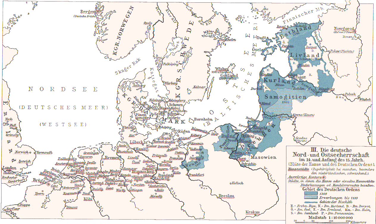
- Hanse cities underlined in red.
- Ordensstaat possessions until 1410 marked in blue colors, with year of acquisition.
- Lands of the bishoprics are marked with first letter:
- Pomesanien, Kulm (Km.), Ermland, Samland in Prussia
- Riga, Kurland, Ösel, Dorpat in the North East
- Towns of Hanseatic League are underlined in red.
Originally from 1901 edition of Putzgers Historischer Schul-Atlas and uploaded to Hanse.jpg as 100+ year old Public Domain by de:Benutzer:Olbertz. Improved quality and reduced file size by Matthead. See also at maproom.org
|
Ця робота перебуває у суспільному надбанні у країнах і територіях, де авторське право охороняється протягом життя автора та 70 років після того або менше.
| |
| Цей файл визнано вільним від відомих обмежень з боку закону про авторські права, включаючи всі пов'язані і суміжні права. | |
Історія файлу
Клацніть на дату/час, щоб переглянути, як тоді виглядав файл.
| Дата/час | Мініатюра | Розмір об'єкта | Користувач | Коментар | |
|---|---|---|---|---|---|
| поточний | 23:31, 2 грудня 2007 | | 1263 × 753 (210 КБ) | Matthead | |
| 10:08, 2 грудня 2007 |  | 1263 × 753 (219 КБ) | Matthead | This map depict the extension of Hanseatic League cities and Teutonic Order lands (blue) in 14th and earl y15th century. Originally from 1901 edition of Putzgers Historischer Schul-Atlas and uploaded to [http://de.wikipedia.org/wiki/Bild:Hans |
Використання файлу
Такі сторінки використовують цей файл:
Глобальне використання файлу
Цей файл використовують такі інші вікі:
- Використання в af.wikipedia.org
- Використання в be-tarask.wikipedia.org
- Використання в de.wikipedia.org
- Використання в en.wikipedia.org
- Використання в et.wikipedia.org
- Використання в frr.wikipedia.org
- Використання в fr.wikipedia.org
- Використання в lt.wikibooks.org
- Використання в sv.wikipedia.org