Файл:SG-Settlements.png

Розмір при попередньому перегляді: 800 × 580 пікселів. Інші роздільності: 320 × 232 пікселів | 640 × 464 пікселів | 1024 × 742 пікселів | 1280 × 928 пікселів | 2560 × 1856 пікселів | 3702 × 2684 пікселів.
Повна роздільність (3702 × 2684 пікселів, розмір файлу: 419 КБ, MIME-тип: image/png)
| Відомості про цей файл містяться на Вікісховищі — централізованому сховищі вільних файлів мультимедіа для використання у проектах Фонду Вікімедіа. |
Опис файлу
| Опис |
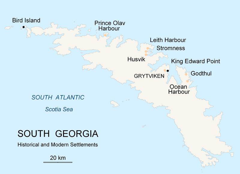
English: Map of South Georgia Island (Settlements) published by the author Apcbg. |
| Час створення | |
| Джерело | Власна робота |
| Автор | Apcbg |
Ліцензування
Я, власник авторських прав на цей твір, добровільно публікую його на умовах такої ліцензії:

|
Дозволяється копіювати, розповсюджувати та/або модифікувати цей документ на умовах ліцензії GNU FDL версії 1.2 або більш пізньої, виданої Фондом вільного програмного забезпечення, без незмінних розділів, без текстів, які розміщені на першій та останній обкладинці. Копія ліцензії знаходиться у розділі GNU Free Documentation License. |
| Цей файл ліцензований на умовах ліцензії Creative Commons Attribution-Share Alike 3.0 Unported | ||
| ||
| Цей шаблон ліцензування був доданий до файлу в рамках оновлення ліцензії GFDL. |
Історія файлу
Клацніть на дату/час, щоб переглянути, як тоді виглядав файл.
| Дата/час | Мініатюра | Розмір об'єкта | Користувач | Коментар | |
|---|---|---|---|---|---|
| поточний | 20:26, 18 листопада 2007 | | 3702 × 2684 (419 КБ) | Apcbg | {{Information |Description=Map of South Georgia Island (Settlements) published by the author Apcbg. |Source=self-made |Date=18 November 2007 |Author= Apcbg }} == Licensing == {{self|GFDL}} |
| 20:16, 18 листопада 2007 |  | 3702 × 2684 (419 КБ) | Apcbg | {{Information |Description=Map of South Georgia Island (Settlements) published by the author Apcbg. |Source=self-made |Date=18 November 2007 |Author= Apcbg }} == Licensing == {{self|GFDL}} | |
| 18:23, 18 листопада 2007 |  | 3702 × 2684 (419 КБ) | Apcbg | {{Information |Description=Map of South Georgia Island (Settlements) published by the author Apcbg. |Source=self-made |Date=18 November 2007 |Author= Apcbg }} == Licensing == {{self|GFDL}} | |
| 11:00, 7 жовтня 2007 |  | 2962 × 1952 (164 КБ) | Apcbg | {{Information |Description=Map of South Georgia Island (Settlements) published by the author Apcbg. |Source=self-made |Date=7 October 2007 |Author= Apcbg }} == Licensing == {{self|GFDL}} | |
| 10:32, 7 жовтня 2007 |  | 2962 × 1952 (164 КБ) | Apcbg | {{Information |Description=Map of South Georgia Island (Settlements) published by the author Apcbg. |Source=self-made |Date=7 October 2007 |Author= Apcbg }} == Licensing == {{self|GFDL}} | |
| 08:42, 7 жовтня 2007 |  | 2962 × 1952 (163 КБ) | Apcbg | {{Information |Description=Map of South Georgia Island (Settlements) published by the author Apcbg. |Source=self-made |Date=7 October 2007 |Author= Apcbg }} == Licensing == {{self|GFDL}} | |
| 21:55, 5 жовтня 2007 |  | 2962 × 1952 (16,57 МБ) | Apcbg | {{Information |Description=Map of South Georgia Island (Settlements) published by the author Apcbg. |Source=self-made |Date=5 October 2007 |Author= Apcbg }} == Licensing == {{self|GFDL}} | |
| 21:36, 5 жовтня 2007 |  | 2962 × 1952 (211 КБ) | Apcbg | {{Information |Description=Map of South Georgia Island (Settlements) published by the author Apcbg. |Source=self-made |Date=5 October 2007 |Author= Apcbg }} == Licensing == {{self|GFDL}} |
Використання файлу
Такі сторінки використовують цей файл:
Глобальне використання файлу
Цей файл використовують такі інші вікі:
- Використання в af.wikipedia.org
- Використання в ar.wikipedia.org
- Використання в bg.wikipedia.org
- Використання в bs.wikipedia.org
- Використання в ca.wikipedia.org
- Використання в de.wikipedia.org
- Використання в el.wikipedia.org
- Використання в en.wikipedia.org
- South Georgia and the South Sandwich Islands
- Grytviken
- South Georgia
- King Edward Point
- Bird Island, South Georgia
- History of South Georgia and the South Sandwich Islands
- Leith Harbour
- Solveig Gunbjørg Jacobsen
- Prince Olav Harbour
- Godthul
- Ocean Harbour
- Invasion of South Georgia
- Reindeer in South Georgia
- List of settlements in South Georgia and the South Sandwich Islands
- Використання в eo.wikipedia.org
- Використання в es.wikipedia.org
- Використання в et.wikipedia.org
- Використання в fa.wikipedia.org
- Використання в fi.wikipedia.org
- Використання в fr.wikipedia.org
- Використання в fy.wikipedia.org
- Використання в gd.wikipedia.org
- Використання в gl.wikipedia.org
- Використання в he.wikipedia.org
- Використання в hu.wikipedia.org
- Використання в id.wikipedia.org
- Використання в incubator.wikimedia.org
Переглянути сторінку глобального використання цього файлу.