Файл:Map of the partition of the Kingdom of Poland and the Grand Duchy of Lithuania from 1799.jpg

Розмір при попередньому перегляді: 669 × 600 пікселів. Інші роздільності: 268 × 240 пікселів | 535 × 480 пікселів | 856 × 768 пікселів | 1142 × 1024 пікселів | 2284 × 2048 пікселів | 6330 × 5677 пікселів.
Повна роздільність (6330 × 5677 пікселів, розмір файлу: 6,83 МБ, MIME-тип: image/jpeg)
| Відомості про цей файл містяться на Вікісховищі — централізованому сховищі вільних файлів мультимедіа для використання у проектах Фонду Вікімедіа. |
Опис файлу
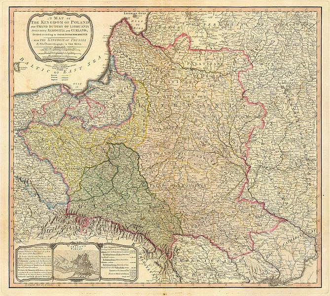
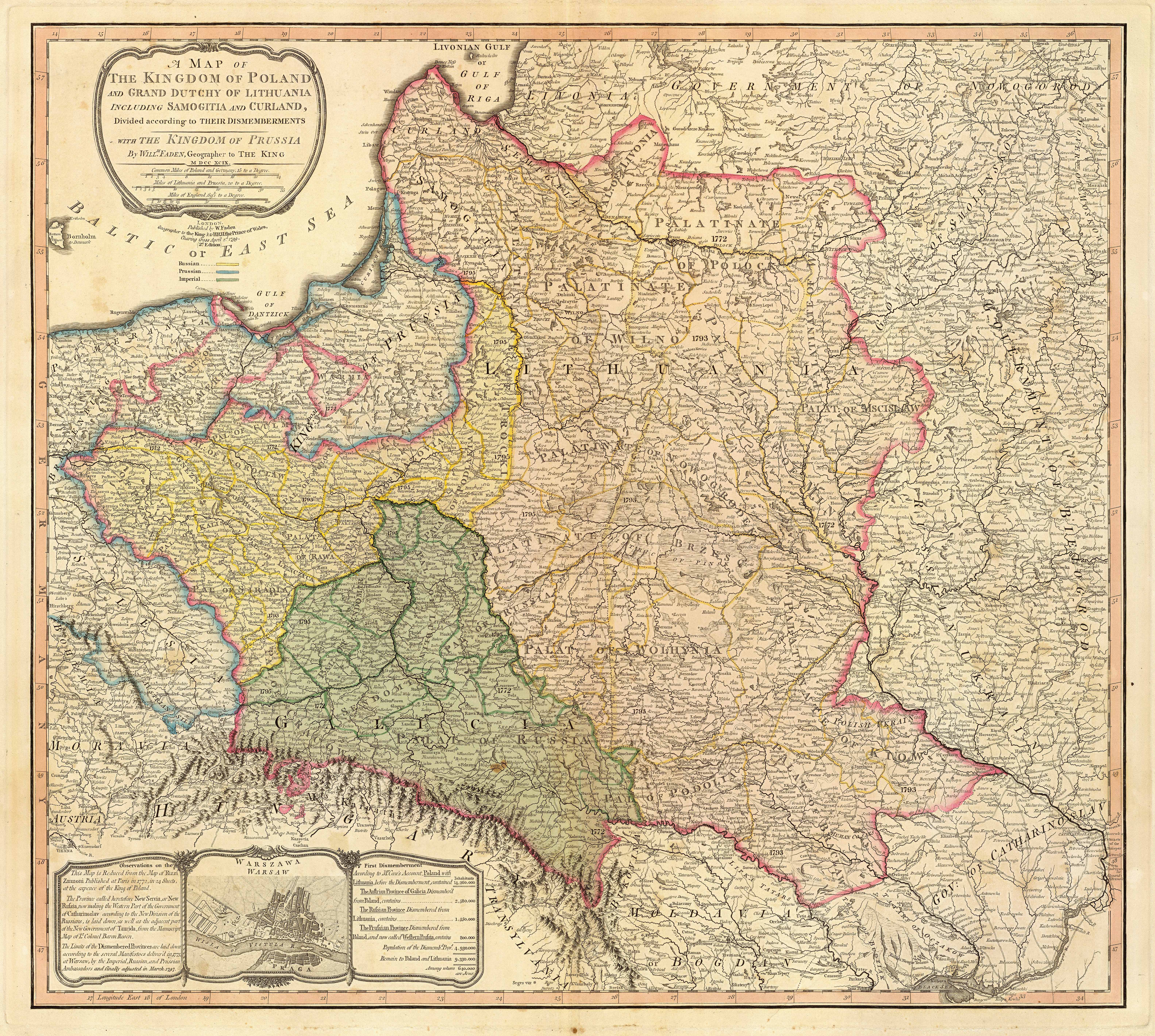
| Опис | Title: "A map of the Kingdom of Poland and the Grand Duchy of Lithuania including Samogitia and Curland divided according to their dismemberments with the Kingdom of Prussia". A map from 1799 showing how the Polish-Lithuanian Commonwealth was partitioned in 1765-1795 between Prussia, Austria, and Russia. This is an extremely detailed map which lists all the cities and small towns and labels the regions according to their English names. The boundaries former Polish-Lithuanian Commonwealth colored light red. The areas taken by Prussia are colored yellow, those taken by Austria colored green, and those taken by Russia are colored beige. Prussia itself is bordered in blue. Eastern Pomerania and Warmia are shown as part of Prussia but bordered in red as well. | ||||||||||||||||||||||
| Час створення | |||||||||||||||||||||||
| Джерело | http://www.belarusguide.com/images/maps/Kokosha/POlonia&Lituania-1799.jpg | ||||||||||||||||||||||
| Автор |
|
||||||||||||||||||||||
Ліцензування
|
Ця робота перебуває у суспільному надбанні у країнах і територіях, де авторське право охороняється протягом життя автора та 100 років після того або менше. | |
| Цей файл визнано вільним від відомих обмежень з боку закону про авторські права, включаючи всі пов'язані і суміжні права. | |
Історія файлу
Клацніть на дату/час, щоб переглянути, як тоді виглядав файл.
| Дата/час | Мініатюра | Розмір об'єкта | Користувач | Коментар | |
|---|---|---|---|---|---|
| поточний | 05:04, 23 вересня 2007 | | 6330 × 5677 (6,83 МБ) | Archaeogenetics | {{Information |Description=Title: "A map of the Kingdom of Poland and the Grand Duchy of Lithuania including Samogitia and Curland divided according to their dismemberments with the Kingdom of Prussia". A map from 1799 showing how the Polish-Lithuanian Co |
Використання файлу
Така сторінка використовує цей файл:
Глобальне використання файлу
Цей файл використовують такі інші вікі:
- Використання в en.wikipedia.org
- Використання в et.wikipedia.org
- Використання в lt.wikipedia.org
- Використання в lt.wikibooks.org
- Використання в pnb.wikipedia.org
- Використання в th.wikipedia.org
- Використання в ur.wikipedia.org
- Використання в zh.wikipedia.org