Файл:India-Pakistan Borderlands at Night.JPG
Розмір при попередньому перегляді: 800 × 532 пікселів. Інші роздільності: 320 × 213 пікселів | 640 × 426 пікселів | 1024 × 681 пікселів | 1280 × 852 пікселів | 2560 × 1703 пікселів | 4256 × 2832 пікселів.
Повна роздільність (4256 × 2832 пікселів, розмір файлу: 3,11 МБ, MIME-тип: image/jpeg)
| Відомості про цей файл містяться на Вікісховищі — централізованому сховищі вільних файлів мультимедіа для використання у проектах Фонду Вікімедіа. |
Опис файлу
| Опис |
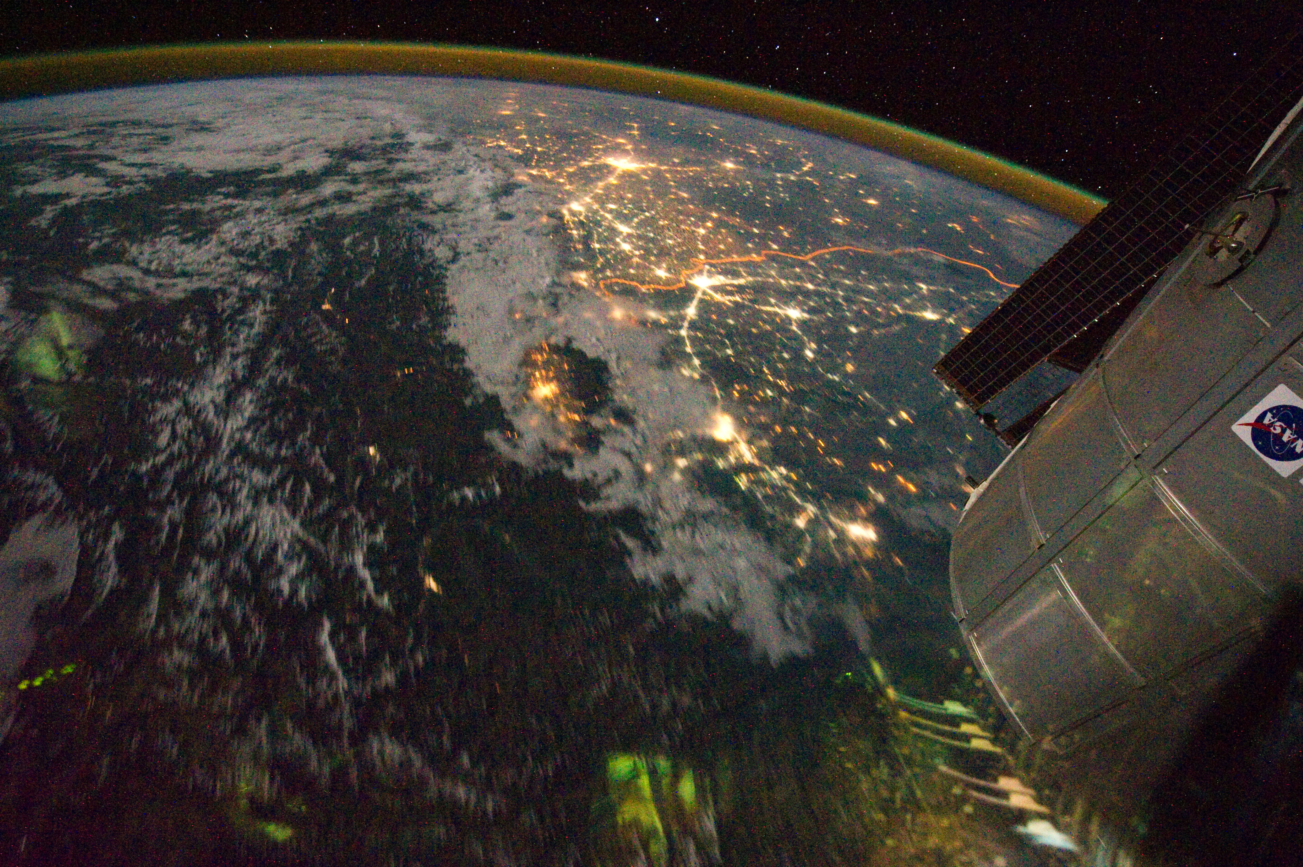
English: Clusters of yellow lights on the Indo-Gangetic Plain reveal numerous cities large and small in this astronaut photograph of northern India and northern Pakistan.
|
| Час створення | |
| Джерело | NASA Earth Observatory |
| Автор | ISS Expedition 28 crew |
| Місцеположення камери | | Перегляньте це та інші зображення поблизу на: OpenStreetMap |
|---|
Це зображення або відео внесене у каталог Космічного центру Ліндона Джонсона Національного управління з аеронавтики і дослідження космічного простору США (NASA)під фото ID: ISS028-E-29679. Це не тег авторських прав. Дійсна ліцензія має додаватись до цього тегу. Інші мови:
|
Image acquired with a Nikon D3S digital camera using a 16 mm lens, and is provided by the ISS Crew Earth Observations experiment and Image Science & Analysis Laboratory, Johnson Space Center.
Ліцензування
| Цей файл перебуває у суспільному надбанні, оскільки він був створений NASA (Національним управлінням з аеронавтики і дослідження космічного простору). Згідно з політикою NASA стосовно авторського права, «матеріали NASA не захищаються авторським правом, якщо не вказано протилежне». (Див. Template:PD-USGov, сторінку політики NASA стосовно авторського права, або політику використання зображень JPL.) | ||
 |
Попередження:
|
| Анотації | Це зображення має анотації: Переглянути анотації на Вікісховищі |
Історія файлу
Клацніть на дату/час, щоб переглянути, як тоді виглядав файл.
| Дата/час | Мініатюра | Розмір об'єкта | Користувач | Коментар | |
|---|---|---|---|---|---|
| поточний | 15:03, 6 вересня 2011 | | 4256 × 2832 (3,11 МБ) | Originalwana | {{Information |Description ={{en|1=Clusters of yellow lights on the Indo-Gangetic Plain reveal numerous cities large and small in this astronaut photograph of northern India and northern Pakistan. Of the hundreds of clusters, t |
Використання файлу
Така сторінка використовує цей файл:
Глобальне використання файлу
Цей файл використовують такі інші вікі:
- Використання в ar.wikipedia.org
- Використання в bh.wikipedia.org
- Використання в bn.wikipedia.org
- Використання в ca.wikipedia.org
- Використання в en.wikipedia.org
- Використання в hi.wikipedia.org
- Використання в sl.wikipedia.org
- Використання в sr.wikipedia.org
- Використання в ta.wikipedia.org
- Використання в te.wikipedia.org
- Використання в vi.wikipedia.org