Файл:Gardens at Chateau de Versailles, France (8132658193).jpg
Повна роздільність (3870 × 2570 пікселів, розмір файлу: 5,78 МБ, MIME-тип: image/jpeg)
| Відомості про цей файл містяться на Вікісховищі — централізованому сховищі вільних файлів мультимедіа для використання у проектах Фонду Вікімедіа. |
.jpg)
Опис файлу
| Опис |
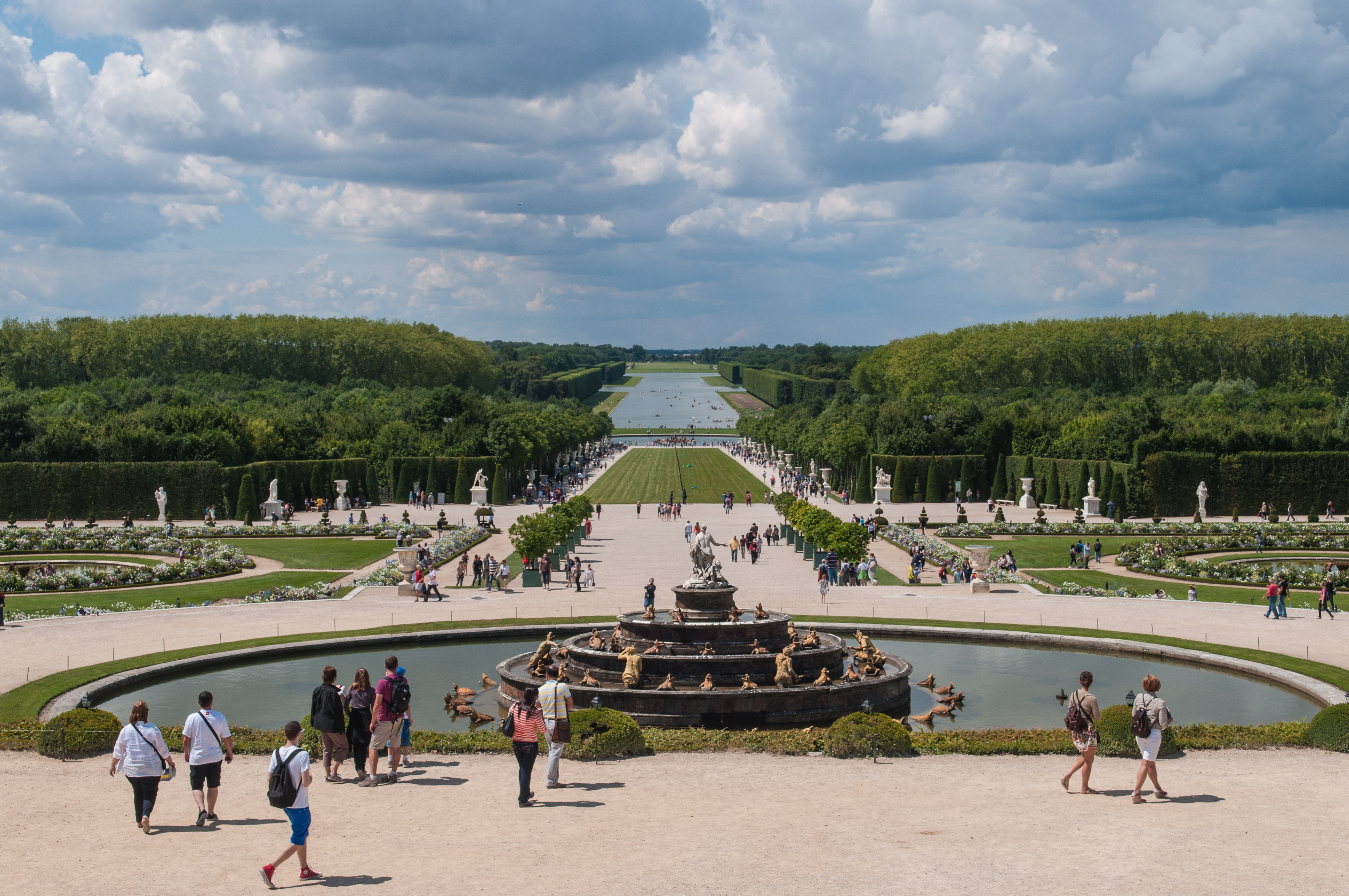
From the central window of the Hall of mirrors the visitor look down on the grand perspective that leads the gaze from the Water Parterre to the horizon. This original perspective, which preceded the reign of Louis XIV, was developed and prolonged by the gardener André Le Nôtre by widening the Royal Path and digging the Grand Canal. This vast perspective stretches from the façade of the Château de Versailles to the railings of the park. In 1661, Louis XIV commissioned André Le Nôtre with the design and laying out of the gardens of Versailles which, in his view, were just as important as the Château. The works were undertaken at the same time as those for the palace and took forty years to complete. But André Le Nôtre did not work alone: Jean-Baptiste Colbert, Superintendent of the King’s Buildings, directed the project from 1664 to 1683; Charles Le Brun, appointed First Painter of the King in January 1664, produced the drawings for a large number of statues and fountains; and, a little later, the architect Jules Hardouin-Mansart drew up increasingly understated scenic plans and built the Orangerie. Lastly, the King had all the projects submitted to him and wanted the “details of everything”. The laying out of the gardens required enormous work. Vast amounts of earth had to be shifted to lay out the flower beds, the Orangerie, the fountains and the Canal, where previously only woods, grasslands and marshes were. The earth was transported in wheelbarrows, the trees were conveyed by cart from all the provinces of France and thousands of men, sometimes whole regiments, took part in this vast enterprise. Since 1992, the gardens have been gradually replanted, and after the devastating storm of December 1999, the work speeded up to such an extent that quite a few sections have already been restored to their original appearance. |
| Час створення | |
| Джерело | Gardens at Chateau de Versailles, France |
| Автор | Michal Osmenda from Brussels, Belgium |
| Місцеположення камери | | Перегляньте це та інші зображення поблизу на: OpenStreetMap |
|---|
.jpg¶ms=048.804884_N_0002.120490_E_globe:Earth_type:camera_source:Flickr_&language=uk)
Ліцензування
- Ви можете вільно:
- ділитися – копіювати, поширювати і передавати твір
- модифікувати – переробляти твір
- При дотриманні таких умов:
- зазначення авторства – Ви повинні вказати авторство, надати посилання на ліцензію і вказати, чи якісь зміни було внесено до оригінального твору. Ви можете зробити це в будь-який розсудливий спосіб, але так, щоб він жодним чином не натякав на те, наче ліцензіар підтримує Вас чи Ваш спосіб використання твору.
| Це зображення, початково опубліковане на Flickr, перевірено 3 лютого 2013 адміністратором або перевіряльником ліцензій File Upload Bot (Magnus Manske), який підтвердив, що воно було доступне на Flickr під вказаною ліцензією станом на вказану дату. |
Історія файлу
Клацніть на дату/час, щоб переглянути, як тоді виглядав файл.
| Дата/час | Мініатюра | Розмір об'єкта | Користувач | Коментар | |
|---|---|---|---|---|---|
| поточний | 03:11, 3 лютого 2013 | | 3870 × 2570 (5,78 МБ) | File Upload Bot (Magnus Manske) | Transferred from Flickr by User:russavia |
Використання файлу
Така сторінка використовує цей файл:
.jpg)