Файл:Cotton-map-transcript.png
Повна роздільність (819 × 966 пікселів, розмір файлу: 284 КБ, MIME-тип: image/png)
| Відомості про цей файл містяться на Вікісховищі — централізованому сховищі вільних файлів мультимедіа для використання у проектах Фонду Вікімедіа. |
Опис файлу
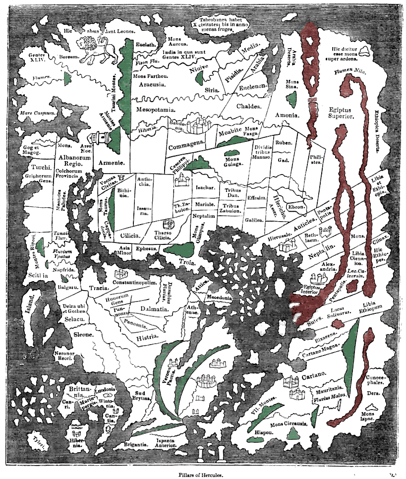
| Опис | Tracing of the 'Cotton' Anglo-Saxon world map (British Library; Cotton MSS, Tib. B. V, folio 56.; date probably about AD 1000) as published ca. 1836 with printed place-names. Ceylon ("Taprobanea") is at top, Britain at lower left. Green and red colours have been added by me to indicate similarly coloured areas (representing mountains and the waters of Africa respectively) on the original map. Please note that accuracy of the tracing and caption transcripts is not guaranteed. |
| Час створення | (transcript c1836) |
| Джерело | Knight, Charles (comp.) "Old England: A Pictorial Museum", London, Sangster (c1836) |
| Автор | Unknown (medieval), redrawn ca. 1836 |
Ліцензування
|
Ця робота перебуває у суспільному надбанні у країнах і територіях, де авторське право охороняється протягом життя автора та 70 років після того або менше.
| |
| Цей файл визнано вільним від відомих обмежень з боку закону про авторські права, включаючи всі пов'язані і суміжні права. | |
Історія файлу
Клацніть на дату/час, щоб переглянути, як тоді виглядав файл.
| Дата/час | Мініатюра | Розмір об'єкта | Користувач | Коментар | |
|---|---|---|---|---|---|
| поточний | 21:03, 4 лютого 2008 | | 819 × 966 (284 КБ) | David Trochos | {{Information |Description= Tracing of the 'Cotton' Anglo-Saxon world map (British Library; Cotton MSS, Tib. B. V, folio 56.; date probably about AD 1000) with printed place-names. Green and red colours have been added by me to indicate similarly coloured |
Використання файлу
Така сторінка використовує цей файл:
Глобальне використання файлу
Цей файл використовують такі інші вікі:
- Використання в de.wikipedia.org
- Використання в ja.wikipedia.org
- Використання в pt.wikipedia.org